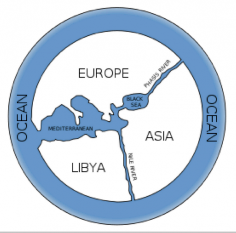
The Greek philosopher Anaximander believed the world to be shaped like a barrel and that humans inhabited the flat top. He was the first to draw a map of the world as a flat round button with a border of blue, representing the ocean. Three blue streams of water divided the world into three practically equal portions. The map resembles today’s Mercedes Benz logo. With this mappa mundi, Anaximander consolidated the three known regions of the world at that time: Europe, Asia, and Libya (part of Africa). Those who are familliar with the study of cartography understand the difficulty in drawing up a map based soley on experience.
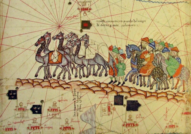
Take, for instance, the Catalan Atlas, consisting of 8 parts, from 1375. The map follows Marco Polo’s journey and could be compared to a medieval comic strip: a camel drawn caravan rides past castles, cities, through criss crossed routes, two naked men dive for pearls, a servant drives an elephant with the snap of a whip, and text fills the empty spaces. The book, II Millione attempts to provide exact details of his journey but it remains unclear to the geographer how to compile a map using vague descriptions such a day of travel, a day of sailing, or two days walking. The atlas is an amazing visualisation of an unknown world.

For many years, many speculated wildly on the shape of the earth. Flat, round, or oval and shaped like a zeppelin. Mathematicians broke their heads over how an oval shape could be translated to a flat paper. As early as the second century, Ptolomeus folded a sheet of papyrus into a cone, drew all he knew of the Earth, and flattened it. A map. He also introduced the concept of the meridian, lines of latitude and longitude and introduced a catalogue of names of places and their coordinates. He understood that distance and direction were the most vital components to any map.
Artists love maps, their systems, the legend, and the puzzle of depiction. They often make a version of the “real” map to which they can add their own truth. The surrealists were in shock from the horrors of the first world war, and Paul Éluard rearranged the world in a map of the world in which the world’s “pure” cultures were give prominence and some World War I countries were given little to no territory.
The artist Annesas Appel is obesessed with maps and systems. Like the early cartographers, Appel attempts to visualise that which we’re not capable of understanding.
In the View on the World Map 04 (Entities 2013), Appel presents her view on the world in the form of a book. After searching the Internet, she stumbled upon the Bosatlas (the most popular Dutch atlas) on which Europe is centrally placed. We’re so accustomed to this map that we hardly consider the option that this is a choice, one could also use Jerusalem as a map’s central point, like the faithful did. Or Russia. Annesas Appel contextualises herself with the Western tradition in which each individual sees him or herself as the centre of the world.
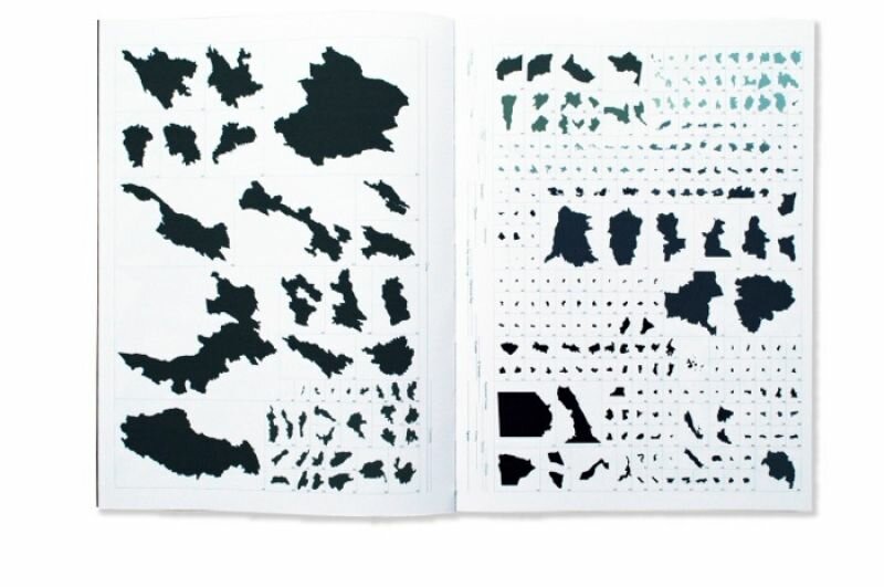
According to the Bostatlas there are 232 countries. Annesas Appel begins by isolating each country from the grand scheme and proceeds to very carefully draw each province of every country. She then lists each province alphabetically, but leaves out the names of the countries to which they belong. The provinces of Afghanistan, Albania, Algeria, Andorra, and so on, follow one another in a long string, page after page. Appel’s atlas is not a fantastical creation, but a new rendition of the scientific Bostatlas. All is drawn to scale, all must be accurate. The Russian sub-region, Yakoetie, is relatively enormous and, however impractical, its true to life scale is accurate in providing a measure for the rest of the provinces portrayed.
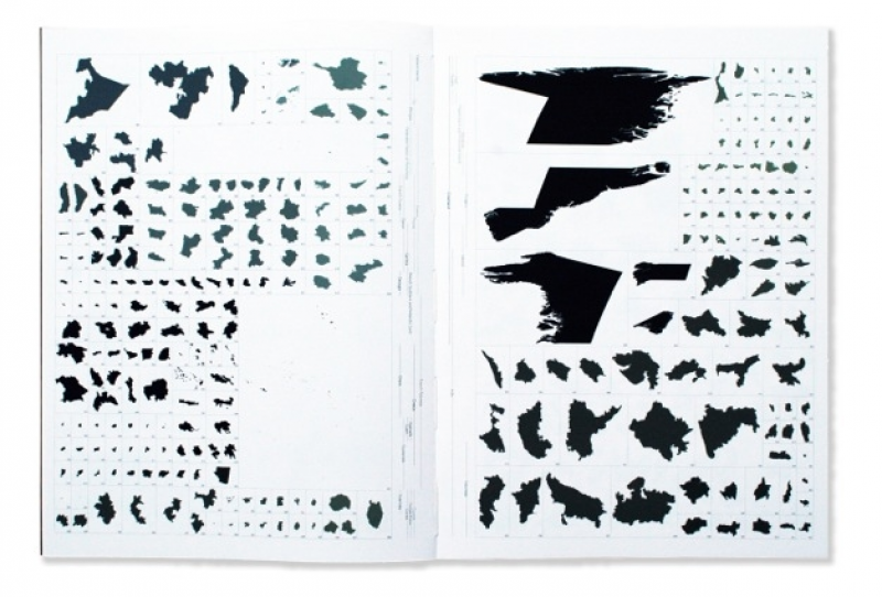
The Netherlands consists of 12 provinces that you think you may know, but once removed from their whole they look like flimsy abstract bits, like little animals or fluffs of moss. American provinces seem like they’ve been drawn with a ruler and the legend shows that the Cook Island provinces are too small to even see.
It would be grand if, like Ptolomeus, the atlas included a register in a long and seductive list of exotic names, like Badakhshan, Badghis, Baghlan, Balkh, Manyan, Daykundi, Farah, Frayab and so forth.
For more, please see: http://www.annesas.nl/