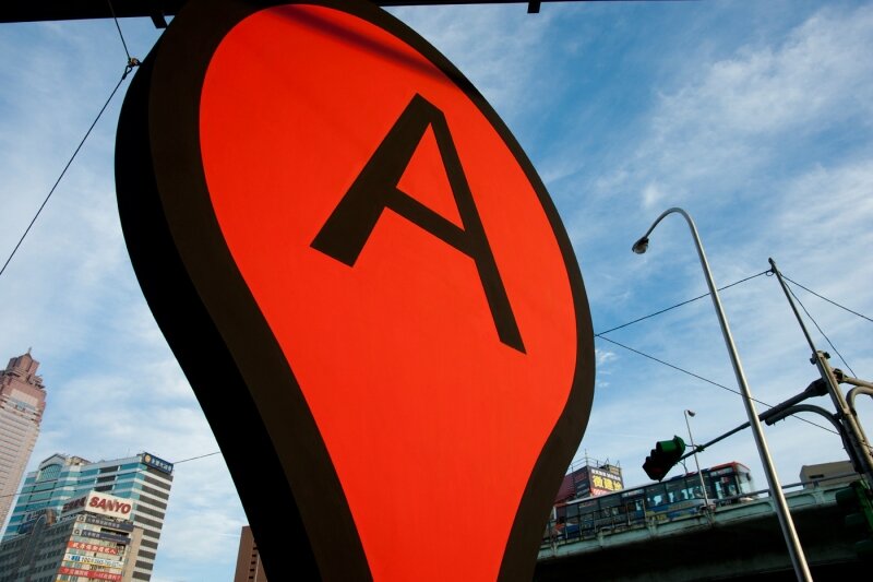
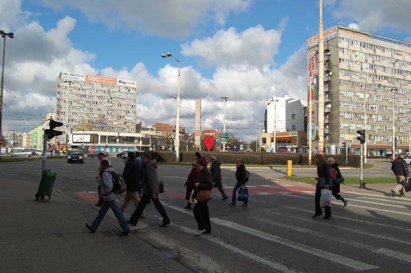
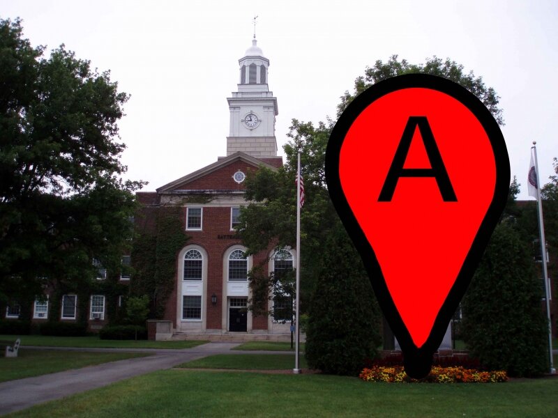
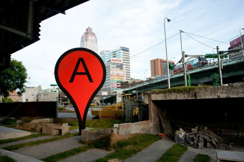
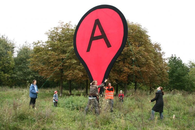
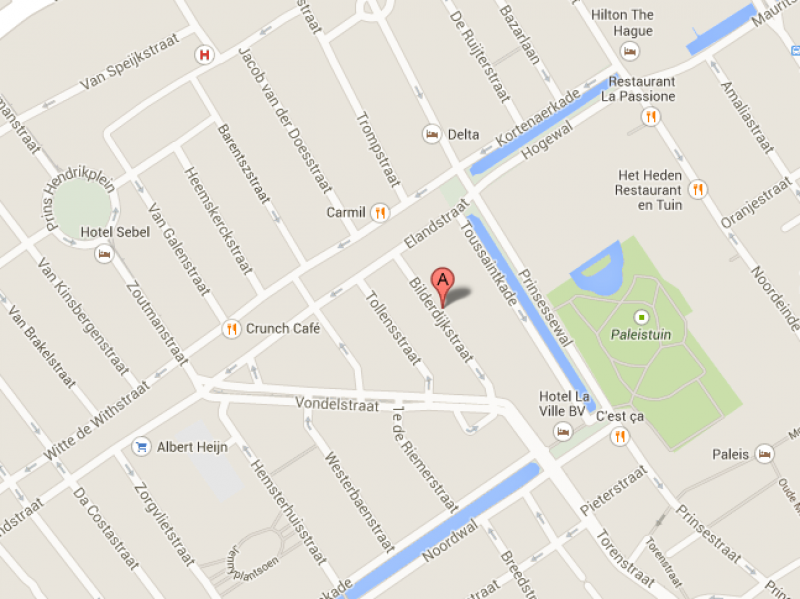
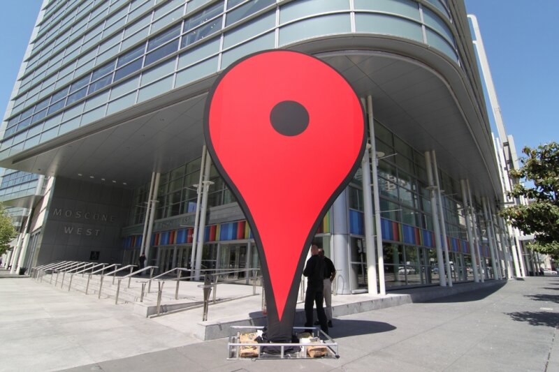
Related to the idea of Dataspace is the project 'Map' by German artist Aram Bartholl. It is a public space installation that questions the red map marker of location-based search engine Google Maps. "Find local businesses, view maps and get driving directions in Google Maps." With a small graphic icon Google marks search results in the map interface. The design of the virtual map pin seems to be derived from a physical map needle. On one hand, the marker and information speech bubble next to it cast a shadow on the digital map as if they were physical objects. When the map is switched to satellite mode it seems that they become part of the city. On the other hand it is a simple 20 px graphic icon which stays always at the same size on the computer screen. The size of the life size red marker in physical space corresponds to the size of a marker in the web interface in maximal zoom factor of the map. Where is the center of a city?
Part of a series, 'Map' is set up at the exact spot where Google Maps assumes to be the center of the city. Transferred to physical space, the map marker questions the relation in which the digital information space stands to public city space, the space of everyday life. The perception of the city is increasingly influenced by geolocation services.