241 Things

1000 Things is a subjective encyclopedia of inspirational ideas, things, people, and events.

Read the most recent articles, or mail the to contribute.

Studium Generale 1000things lectures, The Hague

241 Things

We drive through the hilly woodlands of northern England. Our bus only just makes it through the winding roads to the entrance gate where we alight and walk up the hill through the wet grass into the cold evening. In the distance, a small structure stands in darkness. It’s Kurt Schwitters’ Merz Barn.

In the 1920s Schwitters began his Merzbau in Hannover by dramatically transforming the rooms in his house and studio into abstract grottos by manically covering walls, ceilings and floors with plaster, wire, wooden structures, paint, and strange objets trouvés. The Hannover Merzbau were completely destroyed by Allied bombs.

Hannover Merzbau

After being labelled an Entartete Kunstler (degenerate artist) by the Nazis, Schwitters fled Germany and landed in Norway where he built his second Merzbau, the ‘Haus am Bakken.’ This Merzbau, of which no photographs exist, was also destroyed within a decade of its construction.

Kurt Schwitters

The last and unfinished Merzbau is the Elterwater Merzbarn in Cumbria where Schwitters lived from 1945 until his death three years later. This structure was to become a modernist cavern with every wall smothered in thick layers of impasto, where sculptures would erupt from the surfaces in abstracted organic forms to echo the surrounding landscape. In this remote area, Schwitters worked devotedly at finishing what was to be his masterpiece through the cold, wet weather in that little barn that flooded whenever the rains grew heavy. He never managed to complete the work, and died after only having finished one wall.
Entering the Merzbarn by night

We’re met by the live-in caretaker of the property, Ian Hunter, a greying man dressed in simple clothes. He shines a flashlight into the tiny dark empty barn where there’s little to be seen but a life sized photograph of where the wall used to stand. The original was moved; bricks, mortar, and all, to the museum in Newcastle after it had lain in neglect for decades. He tells us of how Schwitters denounced his German nationality, of his contribution to Modernist art, and mostly, of his love for the artist and his joy at owning the property where Schwitters once worked.

Merzbarn by day

Ian leads us out of the barn and we’re taken into a second structure, another small barn that Ian and his wife have transformed into a kitchen and dining room where two enormous pans filled with steaming hot soup await us. While we eat, Ian begins to tell us of how he found the barn in complete disarray and could not bear to leave Schwitters’ legacy to rot. And so, he left his well-paid curatorial job at a museum, bundled his savings and bought the property that he now maintains from his own pocket.

Soup at the Hunter residence, 2013

Outside again, he shines his flashlight onto a grassy hill. That’s where he plans to build the Merz Shed, a structure to act as a gallery and education centre. Soon, a replica of the torn out wall should be erected where the original stood. He hopes a Kurt Schwitters museum will follow in a nearby town. 6 million pounds would suffice. As of now, there’s been no positive response from the funding bodies. Until then, Ian will remain living on the property and lovingly care for that little barn that carries the traces of Schwitters’ last Merzbau.

Kurt Schwitters in front of the Merz Barn in Cumbria, accompanied by fellow artist-in-exile Hilde Goldschmidt, 1947

The Stasimuseum in Berlin is full of silent witnesses that give the viewer a glimpse of the doings of the former Ministerium für Staatssicherheit of the DDR. From the piece of cloth on which citizens were forced to record the scent of their sweaty hands, to the jacket button that doubled as the control switch for a hidden camera, to the rock containing listening devices to be placed behind park benches.

These are the familiar objects that testify to a bygone time, or like a crime scene, provide evidence for the true story of an unsolved riddle.

Initially, these veritable silent witnesses seem to be props for the permanent exhibition. For decades they’ve been quiet and unobtrusive and their secrets only gradually penetrate consciousness. But if they could talk, their stories would likely reveal more than many a speaking witness.

What intimate conversations did the mother-in-law’s tongues on Minister Erich Mielkes’ secretary’s desk listen in on? And how many silent reproaches have the sansevierias at the entrance to his office endured? The green ensemble in the boardroom, how many strategic decisions has it felt disgusted by? Approved by? And what do the three dracaenas make of their transfer from the once peaceful bedroom to the bustle of the exhibition space where guides and visitors create their own stories?

One can tell from their stature, species, and the vessels that hold them that they are, indeed, well into old age. Sometimes their leaves still rustle from everything they’ve seen and heard. But even now, in their new place within the museum, having moved from room to room many times, their testimony grows greater yet.

‘All animals are equal, but some animals are more equal than others’ goes the famous and absurd line from George Orwell’s Animal Farm (1945). It popped into mind upon seeing stuffed dog heads hanging on the wall of the Horniman Museum. But of course, why not, they belong to the inventory of the animal kingdom. The museum attempts to give a neutral enumeration of things in the world, based on Frederick John Horniman’s private collection. That leads to odd categories and a collection of objects, containing stuffed animals as well as plastic models and skeletons. Less spotted woodpecker, brown rat, passenger pigeon, dodo and kakapo. There is still the optimistic notion in the air that by dividing everything into groups, the world can be controlled and understood. As I observe these categories a young woman asks me if she can make some inquiries about photographing in museums. The last questions concerns my origins, just white, western, European, what do we make of it? She shows me the options and says, yeah, I’m Korean-American, and that’s not in there either. And that is the very issue with classification: there’s always something missing. Completeness is a dream.


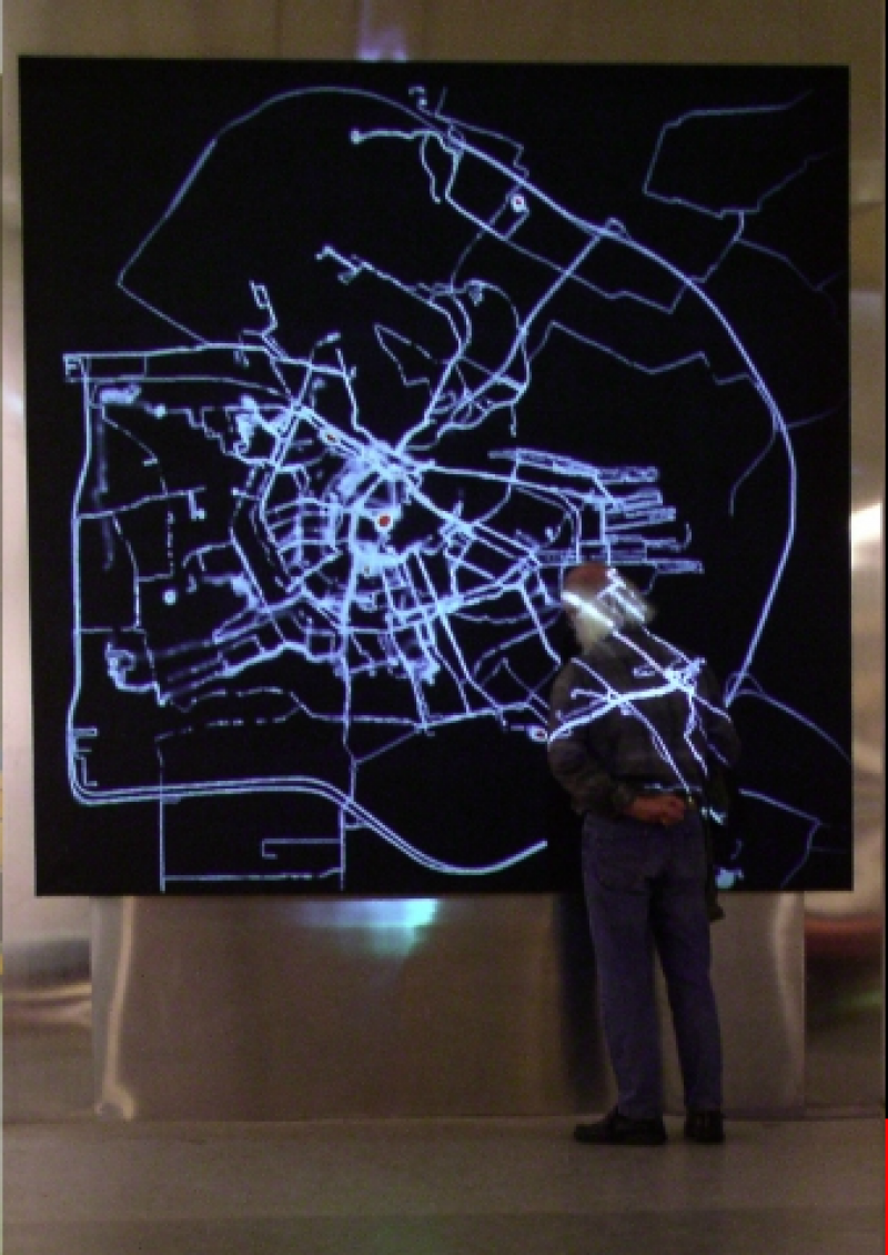
In 2002, I received a New Year’s greeting from the Amsterdam Archive in which they announced a grand exhibition about city maps from across the centuries. I imagined making the most current map of Amsterdam. A living map. Formed by use of the city, using the most modern technology. While traversing the streets, the users of the city would create a trail, as though the streets were formed by the pedestrians the way that roaming cows form paths in the mountains.

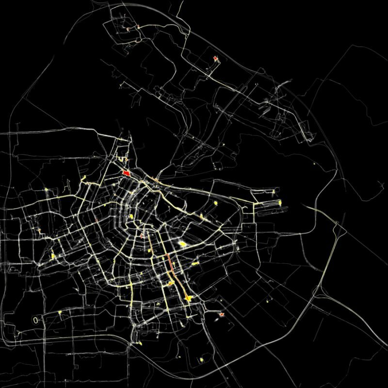
Visible trails. This could be made possible by giving a number of pedestrians a GPS system and sending their information to a central computer. This computer would, in real time, sketch their routes on a blank screen. The more movement and the more users, the more visible Amsterdam would become. Different types of users would be appointed different colours, so that one could see the difference in how the automobile driver, cyclist and pedestrian uses the city.

I called the Municipal Archive and spoke with Ludger Smit. He made the great suggestion of attaching equipment to ducks so that canals too would become visualised. I understood that he understood where I was going.

Every Amsterdammer has, as I imagine, an invisible map of the city in their head. The way they move throughout the city and the choices that he makes while doing so are determined by this mental map.

When different users leave their traces in different colours, the viewer will be able to see how individual the map of Amsterdam can be. The favourite routes of a bike courier differ immensely from that of a taxi driver. The mode of transportation, the customer’s request and the person’s mental map will shape the trail that he leaves behind.

Amsterdam REALTIME

The visual result of 75 GPS-tracked volunteers their different routes in Amsterdam

I imagine that trails older than a few days will erase themselves. In this way, a constantly changing, very current, but also extremely subjective map of Amsterdam will be created.

The data will be stored and will result in a film at the end of the project. In the best case scenario, the film will also provide a time frame that will indirectly make visible large events and crowds, like a marathon or a royal wedding.

A completely different option is to use this installation to undermine the power of the cartographer. It would be possible to invite a number of people to use this drawing machine to create their own map. One could use the GPS system to trace the name of their loved one by cycling through certain streets. Another might attempt to draw the official border of the Vondelpark (regardless of having to brave fences and bushes in the process), Another might decide to walk across the same small path hundreds of time, so that it appears on the map as the most important route in the whole of Amsterdam. However, as more people make use of the GPS tracking system, it will start becoming more recognizable as an objective map.

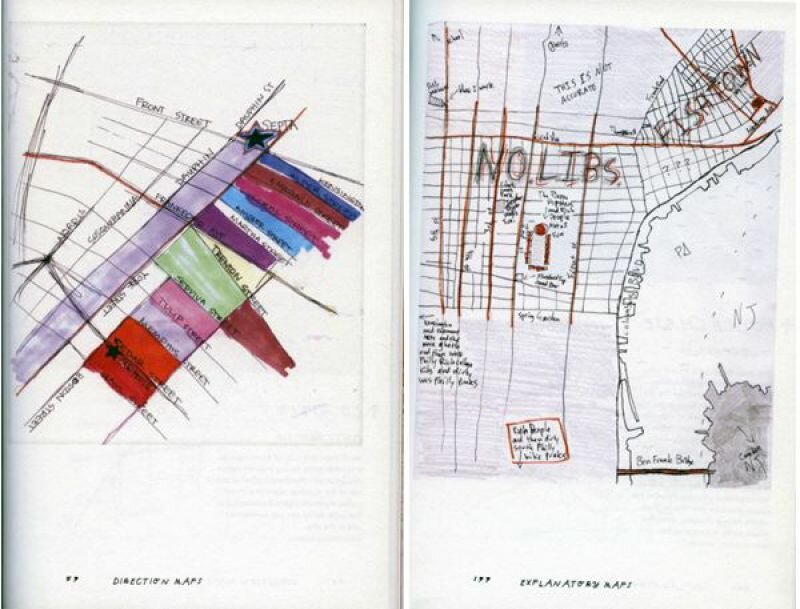
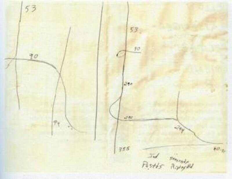
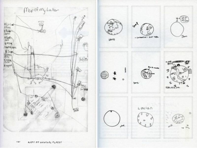
To begin my project, I headed to the Stedelijk Museum’s library to research what other artists have done using maps and charts. What I found most stimulating was a work by Kim Dingle. She had asked teenagers to draw a map of America from their imagination. This resulted in bizarre splotches that she arranged in a rhythmic pattern on a white plane. It looked good as a reproduction. The teenagers were anonymous, yet I could see straight into their minds. It makes one think of the possibility of creating a psychological test based on the analysis of their internal map. You could ask someone: make a realistic map of the terrain that you see as your living environment. A domestic type will draw a map of their house; an adventurous type would draw the whole world. The discrepancies in proportion say a lot about someone’s personality, Reading a palm and reading a map in one.

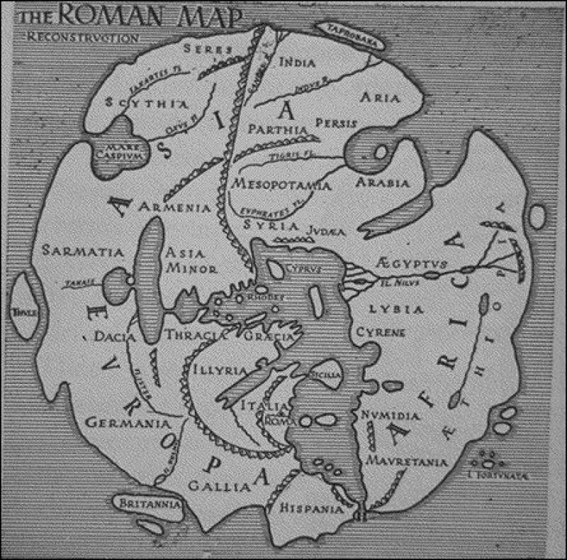
I also found Morit Kung’s book Orbis Terrarum to be fantastic, it contains an extremely rich content. The combination of historical maps and contemporary art is, of course, very relevant to my own projects, and I have to admit that the contemporary works motivate me to study the old maps in more detail. Enjoying these objects is an acquired taste. There are, of course, errors in the maps, but they only make their further accuracy all the more impressive. God knows how they were capable of creating a reasonably accurate depiction of the world back then. Without satellite photos... was this all just done with the aid of a compass and the sun?

Orbis Terrarum - Roman Empire

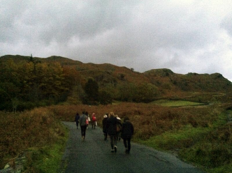
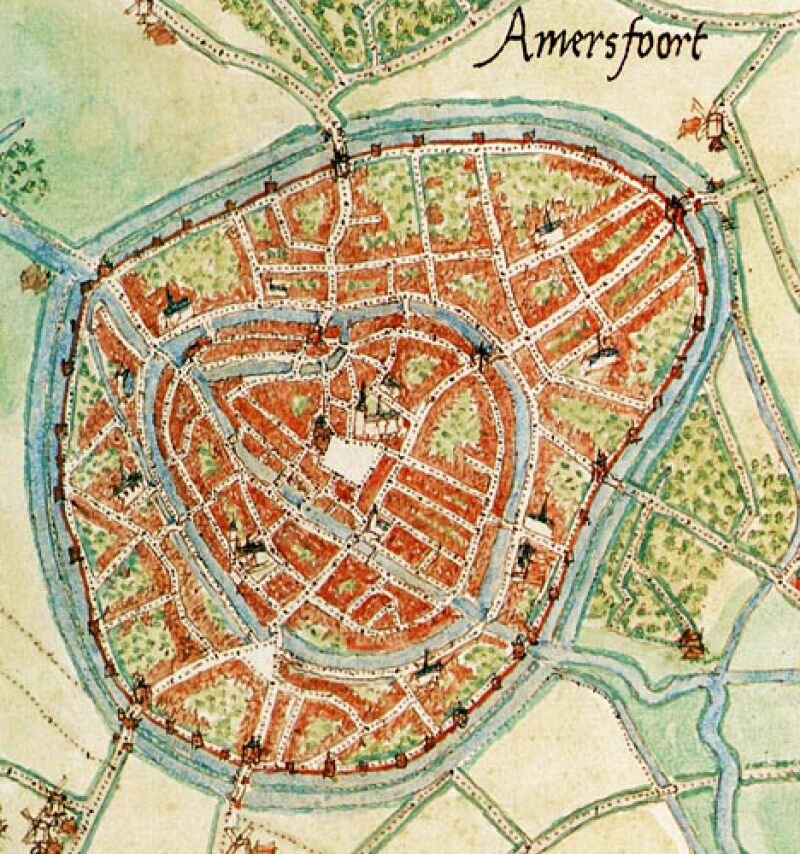
I also attended an event organised by the hiking club Nemo; a lecture by John Eberhardt, head of the publishing company Buijten en Schipperheijn. Eberhardt creates inventories of routes, and so cartography has become his occupation. Cartography is a Dutch invention. A man named Jacob van Deventer was ordered by the king to draw 250 city maps in 30 years by securing a chain between his legs and counting his steps. The maps are still remarkably accurate.

City map of Amersfoort

Made by Jacob van Deventer commissioned by koning Filips II

Eberhardt admitted to mapping stretches of neglected paths as functioning cycle paths, in the hopes that they would end up actually becoming cycle paths. In some cases his plan worked: sometimes so many complaints were issued to the municipality that something really must be done about that bike path. As I heard the cartographer speak about his map, it became apparent that The Map, with its intrinsic air of objectivity and authority, is in fact determined by the subjective choices of the map’s maker and the constraints of technology, time, and money. What I had also never realised is that freedom of press is equally applicable to the publishers of maps. Eberhardt even spoke of the ‘dissident cartographer,’ which I find in itself a beautiful title. The world that is mapped is constantly changing. Each ‘layer’ of the map changes in its own tempo. The difference in the tempo of movement of continents and of migratory birds is immense, and the changes in buildings and plant growth are wedged in between there. His ideal map is one that is in constant movement, which is always changing. My idea of the most current map is very similar. The map itself draws this constant changing of the map.

Reading a map is a form of virtual reality. A model of reality can also change reality (think of the cycle path). By viewing a map through a new perspective, one can discover things that even the cartographer missed. A smart archaeologist, for example, found that all the dolmens of Drenthe are aligned in an exact straight line. The maker of the map had drawn it, but had overlooked it. A map is, then, a reality within itself, where new discoveries are always possible.

A map is also a Utopia. Each map and each user holds his own Utopia. A map for fishermen, hikers, drivers, or geologists each manifests another imagined world. Each map will allow you to enter a landscape with a different experience.

The above idea was executed in 2002 and was one of the first large-scale art projects to use GPS. The project was made into an online version that is still accessible. For more infomation see www.polakvanbekkum.com

There is so much that asks for your attention in the ordinary, everyday life: the shopping lists that have been left in the grocery cart, little papers you find on the street or in the library, notes that have been left in books. I take them with me and collect them for a while, but then I discover a new fascination and the folder with, for example, ‘found items’ is somewhat deserted in my archive. Artists often have better focus and keep collecting to the very end of what might be a beautiful booklet. Artist Kris Harzinski published a paperback titled From Here to There.
handmap spread 1
To prepare his moving to another house, he had started to tidy thoroughly. In one of his stacks of old papers he found a number of maps that people had drawn for him to explain a route or situation. This was the beginning of an archive for maps drawn by hand and the foundation of HDMA, the Hand Drawn Map Association. This collection can be found on www.handmaps.org. A little sketch to show someone the way or to describe a situation mostly shows how incomplete our experience is of the map on which we all move around. During the Venice Biennale I and four others lodged in a wonderful old apartment for a week. On the way back, one of my fellow travelers asked the others to draw a map of it. Which was difficult, for how did that corridor, kitchen and all those rooms fit together again? Five entirely different houses were scribbled onto paper. Giving good directions is often an equally impossible task; you can walk the route without flinching, as if your body intuitively knows the route, but to give a precise description by heart is another matter completely.
handmaps spread 2

Kris Harzinski has collected all these attempts and expanded the series with broader criteria, such as maps that are hand-drawn by artists as official art. The categories are: direction maps, found maps, fictional maps, artful maps, maps of unusual places and explanatory maps. Unusual places contains the drawing by Marilyn Murphy, on which she indicates precisely in which places she is given the injections that are necessary for her arthritis. Harriette Hacker made a map of her face from which all the traces of the past can be read: the chickenpox, the scar from a nasty fall and a single beauty mark.

From Here to There is a beautiful paperback with a small text to accompany each map. However, the small size of the book takes its toll on legibility. Many drawings disappear in the centrefold or are simply too small for all the information. Which is a bit of a shame, because such maps make you want to go through them and sort them out thoroughly.

Everyone can send his or her hand-drawn map to www.handmaps.org.
handmaps spread 3